Bunyan Lake, Located at the base of Castle Rock, near Invermere
The Bunyan mining claim was located on the shoulder of a bluff about 300 feet above the bench lands below, and in 1920 it was decided that the best way to access the ore was to blow off the shoulder with one massive blast and turn the mine into something more resembling an open quarry.
The Mine
Bunyan Lake is named after a copper mining property located on a bluff of Castle Rock, about 300 feet (90 meters) above the bench lands below. The mine was originally staked in 1899 by Orestes A Brown as one of four claims that together were known as the Pilgrim Group.1 Brown himself was a farmer and enthusiastic prospector in the district.2 Within a year, ownership of the property had expanded to include Brown, John H Taynton and William Harrison.3 A small amount of copper ore was sacked in 1900, and another 15 tons in 1904 when a road was built to the property.4 During this time a small amount of development work was done including digging a shaft and a tunnel of about 60 feet, as well as making some cross cuts on the surface.5A “Unique” Plan6
The future fortunes of the Bunyan changed dramatically in 1920 with the help of several tons of dynamite. The claim, then owned by brothers William and John Taynton, was bonded by a group of New York capitalists (Silver Ores Incorporated) with Captain EJ Fader as its manager. Captain Fader decided that the best way to access the ore was to blow off the shoulder of the bluff with one big blast and turn the mine into something more resembling an open quarry. Dynamite was loaded into a tunnel and shaft, packed with dirt at the entrance, and a match set to the four leads. Fader had prepared well for the bounty that would come from his explosive plan. In the year leading up to the event, twelve men were employed adding to the site a bucket tramway, ore houses, bunkhouses for twenty men, a cook house and dry house, a stable for six horses, a blacksmith shop and a powder house.6 The Bunyan was a happening place. Twelve and a half minutes after the match was lit there was a puff of smoke, a loud explosion, and a downpour of ore enriched rock. Approximately 10,000 tons of ore were broken up into man sized lumps of rock, while the face of the mountain 100 by 30 feet (30 by 9 meters) wide, and over thirty feet (9 meters) deep was loosened. A fleet of seven ton Packard trucks was at the ready to carry the loosened ore down to Invermere for shipment.7Results and Closure
A closer inspection of the resulting rubble was disappointing. The explosion had certainly loosened the rock, however rather than turn the mine into an open quarry as planned, it had also badly mixed together the ore and waste rock. The valuable rock was now combined with the junk, so that the rock on the ground was of a very low overall grade. The Bunyan Mine had effectively been blown off the face of the mountain. Attempts were made to recover what minerals they could, but by and large future developments were confined to the lower workings of the mine.8 Even those gave little of value, and by 1922 the property had been abandoned.9
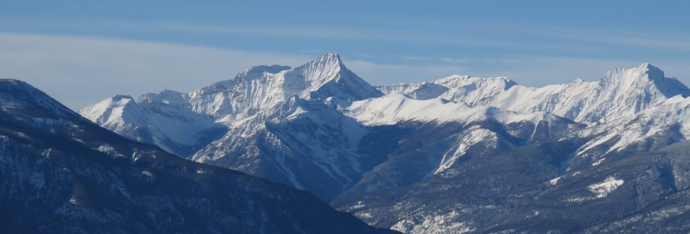
Castle Rock from across Windermere Lake. Windermere Valley Museum, a904
Why Bunyan?
So where exactly did the name “Bunyan” come from? When the mine was originally staked in 1899, it was known as the “Pilgrim Group”, with two of its claims named respectively as the “Pilgrim” and the “Progress.” These were in reference to a well known Christian allegory written by English writer John Bunyan: The Pilgrim’s Progress. An early newspaper article on the claim made reference to this, remarking that, “it is very evident Mr Brown is a better authority on Bunyan than Bunyan was on mining.”10 At the time that article was written, it is unclear but unlikely that any of the claims had been named after Bunyan himself. By 1900 one of the claims had taken on the name “Bunyan,” and by 1903 “Bunyan” had superseded “Pilgrim” for the entire group.See Also
John and William TayntonFootnotes
1. “Round About the Mines,” Golden Era, 27 October 1899, p 1. ↩
https://dx.doi.org/10.14288/1.0227069
2. “Windermere District,” Golden Era, 14 July 1899, p 4. ↩
https://dx.doi.org/10.14288/1.0227142
3. “Windermere News,” Nelson Daily Miner, 22 May 1900, p 3. ↩
https://dx.doi.org/10.14288/1.0082746
4. “Ledge Croppings,” The Outcrop, 30 August 1900, p 1. ↩
http://peel.library.ualberta.ca/newspapers/OTC/1900/08/30/1/
“District Croppings,” The Outcrop, 26 May 1904, p 1. ↩
http://peel.library.ualberta.ca/newspapers/OTC/1904/05/26/1/Ar00102.html
5. “Bunyan Group,” The Outcrop, 16 June 1904, p 1. ↩
http://peel.library.ualberta.ca/newspapers/OTC/1904/06/16/1/Ar00114.html
6. British Columbia. Legislative Assembly. Annual Report of the Minister of Mines for the Year Ending 31st December 1920 Being an Account of Mining Operations for Gold, Coal, Etc., in the Province of British Columbia. (Victoria B.C.: Government Printer, 1921) p N 112 to N 113. ↩ https://dx.doi.org/10.14288/1.0226034
7. British Columbia. Legislative Assembly. Annual Report of the Minister of Mines for the Year Ending 31st December 1920 Being an Account of Mining Operations for Gold, Coal, Etc., in the Province of British Columbia. (Victoria B.C.: Government Printer, 1921) p N 112 to N 113. ↩ https://dx.doi.org/10.14288/1.0226034
8. “Good Ore Values Revealed When Big Blast is Fired,” Cranbrook Herald, 30 September 1920, p 1. ↩ https://dx.doi.org/10.14288/1.0069457
9. British Columbia. Legislative Assembly. Annual Report of the Minister of Mines for the Year Ending 31st December 1920 Being an Account of Mining Operations for Gold, Coal, Etc., in the Province of British Columbia. (Victoria B.C.: Government Printer, 1921) p N 112 to N 113. ↩ https://dx.doi.org/10.14288/1.0226034
10. British Columbia. Legislative Assembly. Annual Report of the Minister of Mines for the Year Ending 31st December 1922.(Victoria B.C.: Government Printer, 1923) p N 185. ↩ https://dx.doi.org/10.14288/1.0300577
11. “Windermere District,” Golden Era, 14 July 1899, p 4. ↩
https://dx.doi.org/10.14288/1.0227142
Other References
BC Geographical Place Names, “Bunyan Lake: S of Toby Creek, W of Invermere”, 50°28’39”N, 116°06’13”W. http://apps.gov.bc.ca/pub/bcgnws/names/2180.html
