Invermere (Community)
Other names: Kya knuqti?it (pronounced kya-k-nook-thi it), Copper City (1898-1899), Canterbury (1899-1910)
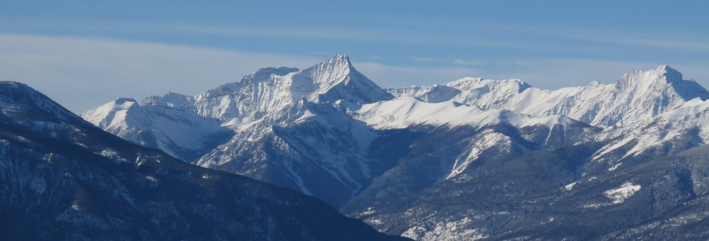
“Invermere… is going to be, when she grows up, …‘the last word in towns.’ … And then the unfortunate souls who are doomed to exist in Calgary and such like places will come in their thousands to Invermere and, for a brief season, live.” (The Columbia Valley Times, 1912)49
The town of Invermere, like all settler towns in the Windermere Valley, is located on land that was never formally ceded from the local Ktunaxa or Shuswap First Nations to the Dominion Government.
The land encompassing Invermere and Athalmer was reportedly first claimed by settlers in 1886, with Charles Frederick Law taking out the equivalent of three pre-emptions under the names of himself, Charles A Warren, Reuben Hamlin, and Albert Colthard. The following year, the other three sold out to Hamlin, who then went into partnership with Edmund Thomas Johnston.1
Hamlin appears to have stepped back or sold out as his name disappears while E.T. Johnston stayed with the property. In 1893 Johnston had title to some 600 to 900 acres and was raising potatoes.2 By 1898 forty to fifty acres of that land was under crop, and Johnston was concentrating on cattle-raising.3 That same year (1898), Johnston sold his ranch for $6,000 to the Mines Development Company of Rossland, who intended to use it as a townsite.4
Copper City
The Mines Development Company was operated under Fred A. Mulholland, and had recently acquired the Swansea Mine for $5,000.5 The Swansea Mine looked very promising, and the syndicate intended to start shipping ore immediately, so it is perhaps not surprising that the owners of the mine decided to create a new townsite in association with the Swansea purchase. Some 100 acres of Johnston’s old ranch was surveyed and laid out into lots for the townsite of Copper or Copper City (the primary ore coming out of the Swansea Mine was copper).6
Copper City was just one of three new townsites being surveyed and promoted in late 1898, the other two being Athalmer at the crossing of the Columbia River, and Columbia City (later Peterborough then Wilmer) between Toby and Horsethief Creeks.7 In 1899 the Windermere townsite also changed hands, with its new owner surveying it and promoting lots.8
The cause of all this townsite excitement wasn’t just the development of the Swansea Mine: there was a broader mining boom in the area with a flood of prospectors arriving and a handful of potentially prosperous mines being promoted. In addition to the Swansea Mine, there was also the Delphine (staked 1897), the Red Line (staked fall 1898), and the Paradise (staked fall 1899). With a number of what seemed to be very good mining properties, the rush to create the next big “boom town” made sense to fortune seekers. It is not surprising that there was intense competition between towns for supremacy – real estate in a successful town was extremely lucrative.
The new townsite of Copper City did not do so well in competition with its rivals. Athalmer was better located to the river crossing and steamboat landing on the Columbia River, and Peterborough (Wilmer) was in closer proximity to the Toby and Horsethief Creek mines. Copper City was also on the opposite side of the river from the Swansea Mine which, when it did ship ore, did so out of Windermere. Still Copper City had the advantage of being “the favorite among the old timers” as it commanded “a grand situation” on the hill overlooking Windermere Lake.9
Copper City’s geographic position seems to be what prompted the decision by Fred Mullholland to pivot away from promoting the townsite as a mining town (Copper City) and shifting to something closer to a tourist town. In September 1899, Mulholland announced that the name of Copper City would be changed and a $5,000 hotel constructed in addition to a $1,000 stables.10 This decision seems to have been made by a separate syndicate from the one holding the Swansea Mine, however Mulholland retained an interest in it.11
Canterbury
The new town name was very briefly reported in The Golden Era to be Scarborough, however this seems to have been an error in reporting as it was the Canterbury Townsite Company of Rossland (capital $100,000) that now owned the property.12 With new ownership of the townsite, a number of improvements were in order. The Canterbury Hotel was built, and Mulholland was able to attract newspaper editor W.P. Evans to move from Kaslo, bringing with him a newspaper press and establishing the first newspaper in the Valley, The Outcrop.13
Evans later recalled that when he moved to Canterbury in about May 1900, the newspaper office was “the first place of business here” in addition to only two homes and five shacks.14 The town grew, but not very much. The hotel was open within a few months, and a general store opened in Canterbury a year later.15
In order to compensate for the Canterbury townsite’s somewhat unfavourable position to the mines up Toby and Horsethief Creeks, a proposal was made in 1900 to clear a track on the south side of Toby Creek in opposition to the road on the north side.16 This route would decrease the distance between the mines and the river and bring shipments through the Canterbury townsite.
This project, which included a proposal for a bridge across Toby Creek, was still being considered a year later, however it didn’t get further than the planning stage.17 It is interesting to note that a road on the south side was eventually built, in 1917, to provide a shorter and more direct route from the Paradise Mine to the ore bins in Invermere.18

Bridge over the Toby Creek Canyon, built 1917. Image MSC130-1197-01 [Toby Canyon Invermere B.C.] courtesy of the British Columbia Postcards Collection, a digital initiative of Simon Fraser University Library.
Slowing Development
Despite initial excitement around Canterbury as a tourist destination, the tourist town never really “took off”. The Canterbury based newspaper The Outcrop moved in May 1902 to Wilmer, then the more bustling of the two centres and closer to the active mining in the areas.19 At around the same time, the Canterbury Hotel operator, Hugh Gordon, also closed up and left to operate a hotel in Golden instead.20 In 1904, the owner of the local general store, W.S. Santo, also moved away.21
The stalled activity of the Canterbury townsite was mirrored by an economic recession elsewhere in the Valley. By this time, the ore in the Swansea Mine had pretty much run out, and mines elsewhere in the area halted development in anticipation of more efficient transportation to ship ore. For years there had been talk about a railway between Golden and Fort Steele, and the CPR surveyed a route up the west side of Windermere Lake past Canterbury in 1905.22 A railway would get ore to smelter much cheaper – an attractive prospect to the various mine owners – however they were doomed to wait for awhile. The Kootenay Central Railway wasn’t officially opened until 1 January 1915.
Still, Canterbury was thought to have certain attractions. There were rumours in 1903 about a golf course being constructed, and that the CPR planned to build a large hotel on “Long Point” (later Canterbury Point, now Fort Point).23 Although the town was quiet, it was still reported as “the most beautiful townsite on earth.”24 This enthusiasm was not confined to the town’s scenic location. The full 1903 quotation regarding the beauty of the town reads: “There is not a Chinaman in Canterbury, and the citizens have no use for any. This adds another attraction to the most beautiful townsite on earth.” The predominantly white settlement of the town was not only recognized, but encouraged.
Growing Excitement
As the first decade of the new century wore on, the area attracted interest for a new kind of investment. The CPR announced plans as early as 1904 to create an irrigation project for farming large tracts of land on the benches above Wilmer, and that plan grew in ensuing years. By 1909, the project was being developed by the Columbia Valley Irrigated Fruit Lands Company (CVI) under the management of Robert Randolph Bruce. The idea behind the company was that the soil south of Wilmer was naturally incredibly fertile (described at times as “phenomenally-prolific” and “capable of growing literally anything.”)25
Such soil only required water to “grow the finest apples, pears, plums, cherries, strawberries and all the small fruits, as well as alfalfa, grain, vegetables, etc.”26 It was deemed a simple matter to divert water from mountain streams to farms in order to bring thousands of acres of land under cultivation. Such an irrigation project would be too expensive for individuals but, with broader investment, the necessary miles of canals, ditches and flumes could be constructed.27 With the construction of the railway, such fruit could easily be brought to market in Calgary and other prairie centres, leaving landowners to rake in the cash.
A key feature of this fruit farming scheme was who it was being marketed to. Settlers were needed: specifically settlers with enough money to invest in land development and to support themselves for a number of years until young fruit trees began producing. The CVI began marketing to a very specific audience. Pamphlets were distributed widely “throughout the English speaking world,” with the intention of attracting, “a large number of British settlers”, specifically “retired army officers and others with comparatively modest means for settlement purposes.”28
This focus: on bringing in English speaking, preferably British settlers, became a key motivator to the development of a tourist town in the area. Recall that the townsite of Canterbury had once been described as “the most beautiful townsite on earth,” and that part of this enthusiasm came from the lack of Chinese settlers on the townsite. As Canterbury had been all but abandoned, that situation still stood. Here was a beautifully scenic location in close proximity to the prospective fruit farms that could serve as a blank slate on which the CVI could construct an idyllic (White) British town – the kind of society that would attract their ideal settler.
Invermere is Created
It is unclear how the financial transaction played out, but at the end of November 1910 the town of Invermere was created and named with the intention of it becoming a summer resort.29 Promotion of Invermere began the following year with an emphasis on its role as a tourist town and on its scenic beauty. Town lots were laid out to underscore the scenery of the area, being positioned not on a grid but “on a landscape basis to conform to the beautifully rounded contour of the ground on which the future town will be built.”30
A good deal of promotion for this scenic town was geared towards the prospective fruit farmer. In anticipation of settlers arriving in 1911, the town was “springing up over night… so that where three weeks ago there was nothing to speak of, today stands a fairly well developed embryonic city.”31 New arrivals were promised a race course, polo grounds, and golf course, as well as excursions for fishing, hunting, and shooting so that, “each and every sport dear to the heart of the Britisher will be available.”32 The Valley was to become a fruit farming paradise, and those fruit farmers would have access to all the pleasures of British life and leisure.
The Early Invermere Townsite
As part of the rush of development, the Canadian Pacific Railway opened a hotel, adding on rooms to the old Canterbury Hotel and opening the Invermere Hotel in August 1911 under the management of the popular hotelier George Starke, who seems to have been recruited for the task.33 The hotel was “one of the finest in the country, being on a level with any of the CPR hotels in British Columbia… on an ideal spot overlooking the lake.”34

The Invermere Hotel. Lake District of Southern British Columbia (Canadian Pacific Railway, 1920) p 3.
Specifically catering to the tourist crowd was also the Invermere Boat House, located in the “little Bay” (likely Taynton Bay), where one might rent canoes, motor boats, camping outfits, shooting equipment and pack and saddle horses.35 There was also talk of a 150 foot (45 metre) wide esplanade on the waterfront skirting the lake.36 This was not a town to be visited by just anyone: it was meant for “discriminating tourists,” and was anticipated to be “the commercial metropolis of the valley.”37
Predictions about Invermere seemed ready to come true. Groups of emigrants arrived from England in 1912 and 1913 to settle on CVI land, many but not all intending to farm.38 Town lots for Invermere were also being sold by the company. Head offices for the CVI were moved from Wilmer to Invermere in 1912, and J.C. Pitts and F.J.B. Hankey Jr set up a general store, in which the first Invermere post office was located (later .39
The Dominion Government also acquired thirty-five acres of land on the townsite, roughly where the Invermere hospital now is now, where they established an Experimental Farm to test varieties and growing conditions of fruits, grains, clovers and potatoes.40

An early CVI map of the townsite of Invermere. The Experimental Farm occupied Lot 1008, just south of Rotten Row (5th St) and north of Kathleen Drive (10th St). Keep in mind that street numbers of this map do not correspond to current numbers. Source: Windermere Valley Museum and Archives.
The Effects of War
Settlement of Invermere slowed drastically with the outbreak of the First World War. Many of the British settlers targeted by the CVI Company were retired Army officers who were either called up or voluntarily returned to their regiments at the outbreak of hostilities. Recruitment rates among other residents of the valley were also high.
Following the war the town of Invermere was again promoted to tourists, this time with a push by the CPR to establish Lake Windermere Camp on Fort Point as an extension of the Invermere Hotel. The camp, opened in 1920, was described as, “a camp for jaded city dwellers”41 and had twenty-five rustic cabins with a large central club house.42 Combined with the completion of the Banff Windermere Highway in 1923, the town of Invermere became a tourist destination aimed particularly towards those interested in the novel transportation of the automobile (the first gas station in Invermere opened in 1919).43 (See References section at end of this post for links to pamphlets for the Lake Windermere Camp.)

Teeing off in front of the Lake Windermere Camp house. The nine hole golf course on Canterbury Point was opened in 1915. it covered about 37 acres with 2,000 yards to play. Bungalow Camps in the Canadian Pacific Rockies (Canadian Pacific Railway, 1921), p 10.
At around the same time as the Lake Windermere Camp was announced, the CPR also shared plans to locate some thirty-five hundred ex-British army officers and their families in the Columbia Valley, particularly on the CVI land holdings near Invermere.44 These numbers were never reached, however interest in the CVI again picked up, and several residences were built on Invermere Heights (the Invermere townsite).45
When the Village of Invermere was eventually incorporated in 1951, it had an area of 54 acres, a population of 670 people, and a school population of 439.46 The population has since grown and aged, but although the economy of the town has fluctuated somewhat over time, its tourist-oriented focus has remained.
So Why ‘Invermere’?
Although I was unable to find a detailed explanation of the origin of the name “Invermere”, I feel quite comfortable speculating. Prepare for some etymology.
Breaking down the name “Invermere”, the word “inver” has Gaelic origins meaning “confluence of waters” or “river mouth”. Place-names with “inver” are very common in Scotland: for example ‘Inverness’ meaning ‘mouth of the river Ness’. The word “mere”, on the other hand, has Old English origins and refers to a body of standing water, such as a lake or a pond, and more specifically a lake that is broad in relation to its depth (a shallow lake). The English lake Windermere is a popular example.
Putting the two words together results in a strange mix of Scottish/Gaelic with Old English that (I assume) is meant to refer to the “river mouth of a shallow lake.” This is definitely more precise than the typical translation of the word “Invermere” by marketing teams as meaning simply “on the lake.”
The decision to change the existing tourist town name of “Canterbury” to “Invermere” is something of a stroke of genius. Aside from the few remaining buildings of the Canterbury townsite, the new town of Invermere had to be built entirely from the ground up. It was a new, exciting tourist town, planned primarily for British settlers, and the name Invermere was perfect in promoting such a town.
Educated travellers and settlers alike would have known that “mere” means lake and that “inver” meant a settlement close to water, so while travelers to a Canadian “Canterbury” were bound to be disappointed, those going to “Invermere” at least knew something of what to expect. This strategy of enforcing the town’s location near a lake is echoed in more recent times by marketing for “Invermere on the Lake”: a slogan reinforcing for new generations the exact same information gleaned by those earlier audiences familiar with the words “inver” or “mere”.
Likely just as important in attracting Old World visitors, the name “Invermere” managed to be both an old name and an innocuous new one. It evoked a number of old world places in Scotland and England without actually being named after any of them. The name “Invermere” remains internationally unique.
I have been unable to confirm who it was that created the name “Invermere”, however the most likely suspect is Robert Randolph Bruce. I’m still getting up the courage to write a full post about Bruce (that man got around), but quick synopsis:
- Bruce was born in Scotland.
- He was well acquainted with various high up officials of the CPR, and was instrumental in the promotion of the Columbia Valley Irrigated Fruit Lands scheme.
- Bruce was what western historians call a booster: a very loud, very energetic promoter of a particular geographic area who worked tirelessly to see their area of choice become a great economic hub. Bruce’s geographic area was the Windermere Valley.
- Bruce was good at naming things (or at least he did it a lot). It is thanks to him that we have names such as Pynelogs and the Lake of the Hanging Glacier. There’s a good chance that he bounced various ideas off of those around him, but the man knew the importance of a good name.
Descriptions of Invermere
Besides the uncomfortable description of Invermere as the most “beautiful townsite on earth” in part due to its lack of Chinese residents, other early descriptions of the town are also interesting. These also typically emphasis its scenic location, with the townsite occupying “a picturesque position on land sloping up from the water… sentineled on every side by massive mountains. The view from the banks overlooking the lake is simply grand, one that would delight the eye of the artist. … No pen, however deftly wielded, can do justice to the picture. It needs to be seen to be appreciated.”47 Some of this early appreciation for the landscape has arguably been lost as the town has been built up with buildings restricting the views.
The amenities of Invermere in comparison to other towns in the area (Athalmer and Wilmer) are also emphasized, with descriptions of it as the “most pretentious of the three [towns], by virtue of a quite superior appearance, a good-sized hotel, several stores, the Canadian Pacific camp, and last, but not by any means least, a nine-hole golf course, much patronized by the Englishmen whose homes surround it, and by summer visitors frequenting the camp…. Some day, it is broadly hinted by the men who are making their homes there now, all of the Lake Windermere country will be immensely popular as a summer resort.“48
This above prediction from 1922 of the area becoming a popular summer resort was not the first of its kind. One of my favourite descriptions about Invermere comes from 1912 and seems particular prescient:
She is going to be, when she grows up, so she says ‘the last word in towns.’ Boulevards, crescents, promenades, gardens, brass bands, mixed bathing and a golf course. And then the unfortunate souls who are doomed to exist in Calgary and such like places will come in their thousands to Invermere and, for a brief season, live.
Invermere is going to offer us, “the simple life de luxe,” that is all the charm of a simple country life combined with the comforts and luxuries of Montreal, Toronto and New York, with a dash of London and Paris thrown in as flavoring.
It is a difficult dish to cook. One has to be so careful that the ingredients are in the right proportions, and that the flavors are not too strong.
But there are some wise men at the head of affairs in Invermere and in due season she should realize her ambition as the playground of the valley.”49
See Also
Footnotes
https://dx.doi.org/10.14288/1.0227097
https://dx.doi.org/10.14288/1.0226970
https://dx.doi.org/10.14288/1.0227026
https://dx.doi.org/10.14288/1.0227046
https://www.newspapers.com/image/499438043
https://dx.doi.org/10.14288/1.0227143
https://dx.doi.org/10.14288/1.0081331
https://dx.doi.org/10.14288/1.0081331
https://dx.doi.org/10.14288/1.0226981
https://dx.doi.org/10.14288/1.0186750
https://dx.doi.org/10.14288/1.0227024
https://dx.doi.org/10.14288/1.0227024
https://www.newspapers.com/image/505423138
http://peel.library.ualberta.ca/newspapers/OTC/1900/06/21/1/Ar00109.html
https://dx.doi.org/10.14288/1.0183109
http://peel.library.ualberta.ca/newspapers/OTC/1902/05/01/1/Ar00104.html
http://peel.library.ualberta.ca/newspapers/OTC/1901/06/06/3/Ad00302_3.html
http://peel.library.ualberta.ca/newspapers/OTC/1901/06/13/1/Ar00102.html
http://peel.library.ualberta.ca/newspapers/OTC/1900/06/07/1/Ar00107.html
http://peel.library.ualberta.ca/newspapers/OTC/1902/05/01/1/Ar00104.html
http://peel.library.ualberta.ca/newspapers/OTC/1902/06/26/4/Ar00404.html
https://dx.doi.org/10.14288/1.0186875
http://peel.library.ualberta.ca/newspapers/OTC/1905/02/09/1/Ar00107.html
http://peel.library.ualberta.ca/newspapers/OTC/1903/04/16/1/Ar00112.html
http://peel.library.ualberta.ca/newspapers/OTC/1903/02/19/1/Ar00103.html
https://www.newspapers.com/image/498044265
https://dx.doi.org/10.14288/1.0304926
https://www.newspapers.com/image/498044265
https://dx.doi.org/10.14288/1.0069892
https://www.newspapers.com/image/419505355
https://dx.doi.org/10.14288/1.0304967
https://dx.doi.org/10.14288/1.0304926
https://www.newspapers.com/image/505167679
https://www.newspapers.com/image/478988270
https://www.newspapers.com/image/500455956
References

Another fantastic piece of research, Alex. I have been sharing your posts on the Facebook group, Lost Kootenays, but you should do that yourself as I know many Kootenay historians love your stories. I can’t wait to read about the redoubtable Robert Randolph Bruce!
LikeLike
Thanks Elinor! Will do regarding Lost Kootenays. I’ll get the courage to work on Bruce’s post eventually – redoubtable indeed!
LikeLike