Palliser River, Palliser Pass
Palliser would likely have been just one more wealthy nineteenth century British man if not for his involvement in the Expedition through what is now western Canada that is colloquially named after him.
From 1857 until 1860, the British North American Exploring Expedition, usually referred to as the Palliser Expedition, travelled through western Canada between Lake Superior and over the Rocky Mountains to provide scientific research and information on the landscape, and to report on its potential for settlement and transportation. This is the first in a series of posts about the Expedition and geographic features named during the Expedition’s travels through the Windermere Valley.
John Palliser
John Palliser was born in Dublin on 29 January 1817 to a distinguished Irish family founded by William Palliser, Archbishop of Cashel, who had come to Ireland from England in 1660.1 Palliser’s father was Colonel Wray Palliser, and his mother was Anne Gledstanes of Annsgift, the Colonel’s eighteen year old ward.2
As the eldest son of an eldest son of a wealthy Irish family, John Palliser was largely educated abroad and spoke French, German, and Italian.3 He was raised to a background of established wealth, moving in “the most eligible society,” and was reported to “delight in dancing and sociability and good cheer generally.”4
Palliser entered Trinity College in Dublin in 1834 at the age of eighteen. He was not a great student, attending classes intermittently, and was absent for six of the twelve terms in which he was registered.5 He eventually abandoned his studies without a degree in 1838.6
Military Career
The following year, on 20 September 1839, John Palliser joined his father’s regiment, the Waterford Artillery Militia, with the rank of Captain.7 There is no record of his being in active service until 1855, when he attended drills in England and commanded a detachment at Duncannon Barracks. He saw service briefly again in 1862 before resigning his commission in 14 July 1864.
Although Palliser was officially in the Waterford Artillery Militia for twenty-five years, and his militia was occasionally called up during that time, Palliser himself was consistently absent during these periods of active service.8 He is typically referred to as ‘Captain Palliser’, but his actual military experience was minimal.9
Palliser also served as High Sheriff of County Waterford, his family’s home, from 1844, and later became Justice of the Peace and Deputy Lieutenant of the County, a position he held until his death.10
Travel and Adventure
John and his four younger brothers were all “seized with a restless spirit”, and all but the youngest were “prodigious travellers.”11 In addition to traveling through Europe, in 1847 John left England for North America, “with all the eagerness of a college student, who casts aside his dull books and duller tutors for a burst after the partridges.”12 He spent the next eleven months on the American prairies hunting buffalo, elk, antelope, and grizzly bears, as well as observing the life of Aboriginal people and fur traders.13 He published an account of this journey in 1853 in a book titled, Solitary Rambles and Adventures of a Hunter in the Prairies.

Portrait of John Palliser, Royal Geographical Society; painted by his sister Mary after a water-colour by Miss Severn, 1852. Printed in: Irene M Spry, ‘Captain John Palliser and the Exploration of Western Canada,’ The Geographical Journal Vol 125, Part 2 (June 1959), p 150.
Palliser would likely have been just one more wealthy nineteenth century British man if not for his involvement in the Expedition through what is now western Canada that is colloquially named after him (see below). He never married, and seemed unable to adapt to the serious decline in the family fortunes, which he inherited with his father’s death in 1862. His frequent travels left him with little time to look after the family estates, and they became heavily mortgaged.14
Aside from his American hunting journey and the British North American Expedition, John’s activities are not widely known or documented. A fire on his family estate in 1923 destroyed his own records and greatly decreased the material available for research.15 There are some vague clues. In 1862 he went to the West Indies on a “semi-official mission, the nature of which remains a mystery.”16 From there he ran through the Yankee blockade to visit the Confederate states.
Palliser passed away 18 August 1887 at his family estate of Comragh House in County Waterford, Ireland.

The fantastic hair styling of John Palliser, unknown date.
The British North American Exploring Expedition
In 1856, just under a decade after his North American hunting trip, Palliser “conceived” of a plan to explore the southern prairies of what was then British North America, as well as the adjacent passes through the Rocky Mountains.17 Palliser’s original proposal, presented to the Royal Geographical Society (RGS) on 24 November 1856, was for a personal journey that made use of local voyagers and hunters.18
It’s not clear the details or motivations behind Palliser’s original proposal. No trace of his “plan” as first presented to the RGS can be found.19 The RGS, however, quickly expanded upon the notion of a solitary journey by recommending an ambitious enterprise including multiple scientific assistants in different disciplines. It also asked the Colonial Office for a grant of £5,000 to help finance the project.20
There were good reasons for the Royal Geographical Society to embrace and expand upon the idea of Palliser’s Expedition. Although there had been a slow accumulation of knowledge about these areas of British North America, and indeed the Hudson Bay Company had a very good working knowledge of the areas Palliser proposed to ‘explore’, such knowledge was not widely accessible or independently confirmed. The HBC was not keen to volunteer information about its trading areas, and information that it did share was likely to be prejudiced.
Other information that had trickled out from the area, such as rumours from the “Red River people” led by James Sinclair over accessible passes through the Rocky Mountains in British territory, were just that: rumours. Without confirmation by an unbiased source, the public and the government, “did not have access to adequate, accurate, and impartial information about that part.”21 In this context, Palliser did not need to make new discoveries in British North America so much as to confirm and document what was already known.
Palliser as Head of the Expedition
For all that it was Palliser who made the initial proposal for the Expedition, his involvement as leader of the venture was not guaranteed. He was a country gentlemen without any business experience or professional training. HBC Governor George Simpson later observed Palliser to be “quite ignorant of business, and unsuited for the duties of the expedition.”22
This is somewhat unfair. Although not a businessman, Palliser did have other talents. Of all the members appointed to the Expedition he was the only one to have experience travelling in western North America.23 Palliser had embraced his earlier experience there, learning how to travel and camp alone, and even proposed to “live off the land” during his time in British North America.24
In addition to this practical experience, Palliser also had the advantage of being without any connection to the HBC or the fur trade.25 He had no personal stake in the future of western British North America or the Hudson Bay Company, and his status as a neutral observer was a valuable asset to the credibility of any resulting report.26
Expedition Members and Goals
As Palliser was not a scientific man, the Expedition Committee of the Royal Geographical Society recommended that he should have help on the trip. The Royal Society was consulted to lay out the scientific goals of the Expedition and, based on a variety of recommendations, four additional officers were assigned to the journey: geologist James Hector, botanist Eugene Bourgeau, magnetic observer Lieutenant Blakiston, and astronomical observer and expedition secretary, John Sullivan.
The Expedition was given instructions to examine the canoe route in British North America west from the Head of Lakes (Lake Superior) to Red River and determine whether it could be shortened, to determine whether there was any prospect of emigration to the prairies or if agriculture would be worthwhile to pursue there, and to establish if there was a mountain pass or passes over the Rocky Mountains within British territory and south of the Boat Encampment (the top of the Big Bend in the Columbia River).27
There are a number of books and reports that document the journey of the Palliser Expedition itself, so there is little point in my repeating them. Nonetheless, a couple of details can be pointed out. The first is the speed with which the Expedition was organized. Palliser presented his mysterious plan to the RGS in November 1856: expedition members set off to North America the following May, just six months later.
What was originally intended to be a two year journey also stretched out to three seasons, lasting until 1860. The first year (1857) was spent west of Lake Superior through the Red River area, with the group wintering at Fort Carlton (north of Saskatoon). The following year (1858), the expedition continued on across the prairies before splitting into branches on different routes into the Rocky Mountains. They wintered in and around Edmonton (during which time Palliser apparently hosted a couple of balls). Finally, the 1859 season involved travels south to Cypress Hills before again going into the Rockies then further west to the coast and Vancouver Island.
Outcomes of the Expedition
The value of the Expedition to people at the time varied depending on who one asked. The travels were deemed quite worthless by HBC men, who considered them to add very little knowledge to areas that were already “well known” to the Company.28 The Royal Geographical Society seemed to have a different perspective. They awarded Palliser with the Patron’s Golden Medal in 1859 for his exploration of the Rocky Mountains, when Palliser himself was still in North America.29
Reports and maps from the Expedition were also published and circulated, containing both new information and confirmation or corrections of what was already known. These established beyond any doubt that there were a number of passes through the Rocky Mountains in British territory, although they also suggested that the Rockies were not the only obstacle to western travel: they noted of the formidable wall of mountains formed by the next mountain range (the Selkirks).30 Most significantly for our purposes, the Palliser Expedition also resulted in a whole pile of names being assigned to geographic features in the territory travelled.
Palliser River
One of the names given during the Expedition was to the Palliser River, which was named in August 1858 by the men accompanying Palliser and John Sullivan as they travelled over what is now known as the South Kananaskis Pass and dropped into the valley beyond.
In his journal entry for 23 August 1858, Palliser recorded that in, “the valley of this river (which the men ever afterwards called Palliser’s river, to distinguish it from the other branch of the Kootanie River) … A remarkable change was observable … in the increased luxuriance of the vegetation, and also in the appearance of shrubs that we had not seen on the eastern side of the mountains. … We continued… alternatively along either side of the stream, crossing the river frequently, and for the sake of convenience sometimes riding in the river itself, in order to avoid the fallen timber. Its valley is of great breadth, and the mountains which form its sides retire to a good distance on either hand.”31

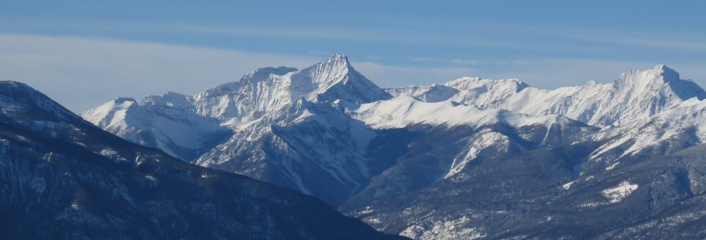
The upper Palliser River Valley (Mt King George to the left) with South Kananaskis Pass marked. Photo: Kris Weller

Looking down the Palliser River Valley from the north, with the South Kananaskis Pass marked. Photo: Ryan Thomas
Palliser and Sullivan continued down the Palliser River valley to where it joined with the Kootenay River, then followed the Kootenay downstream to pass by Upper Columbia Lake (Columbia Lake) before continuing south in an attempt to get to Fort Colville. They were unsuccessful, and returned back over the Rocky Mountains by the North Kootenay Pass.
It is perhaps relevant to note that Palliser Pass was named in association with the Palliser River, and is not the pass that Palliser used to cross over the Rockies. I haven’t seen this mistake made, but there is definitely room for confusion.
Legacy
The maps produced by the Palliser Expedition were used as references for subsequent maps of the area, so the names given by the Expedition tended to stick (in one way or another). We’ll touch on a number of these in subsequent weeks.
If you’re interested in reading more about the Palliser Expedition, I’ve accumulated a bibliography of publicly available maps and reports. These are listed with links at the bottom “References” section of this post.
There are also a number of books documenting the expedition written by Irene Spry, the most comprehensive being The Palliser Expedition: An Account of John Palliser’s British North American Expedition, 1857-1860 and The Papers of the Palliser expedition, 1857-1860. Full citations also listed below.
Footnotes
https://doi.org/10.2307/1790499
https://doi.org/10.2307/1790499
https://doi.org/10.2307/1790499
https://doi.org/10.2307/1790499
https://doi.org/10.2307/1790499
https://doi.org/10.2307/1790499
https://doi.org/10.2307/1790499
https://doi.org/10.2307/1790499
https://doi.org/10.2307/1790499
https://doi.org/10.2307/1790499
https://doi.org/10.2307/1790499
https://doi.org/10.2307/1790499
https://doi.org/10.2307/1790499
https://dx.doi.org/10.14288/1.0221753
https://doi.org/10.2307/1790499
https://doi.org/10.2307/1790499
https://doi.org/10.2307/1790499
https://dx.doi.org/10.14288/1.0221753
References
Journals/Reports
Maps
Books
