Salter Creek (west side Windermere Lake)
The presence of William Salter on the west side of Windermere Lake makes him one of the first and few to settle in that area.
William Salter
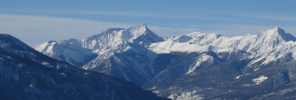
Salter Creek, located directly across the lake from Windermere, was named after William Salter who, for a number of years, lived in a shanty (a shack) on the south side of the creek below the current Westside Road.1
William’s name first appears in records of the area in the 1889 British Columbia Directory, as a rancher living in the Windermere area.2 We get more information about him from the 1891 Canadian census, at which time he was still living in the area. Then age 37, Salter was born in Manitoba, with his father having been born in England and his mother in Manitoba (likely of First Nations descent).3 This matches with a much later note that Salter, “was a native of the Red River settlement.”4
Salter remained a resident of the Windermere area until sometime in the winter of 1893/1894: he is listed as being entitled to vote on the August 1893 voting list,5 and was taken off the voting list by April 1894, having “left the country.”6
An Unknown Identity
The identity of William Salter outside of the valley is unknown, due simply to lack of information. The one possibility that I’ve found is that he was William Robert Salter, born in Manitoba around 1851 to parents Richard Salter, an Englishman, and Mary Ann Smith, born in what later became the North-West Territories.7
William Robert was the eldest of at least six children, and would go on to marry another Mary Ann, born in about 1854 in the future North-West Territories. The couple were living along the Bow River in 1881 with two children.8 William Robert then disappears from records until 1906, when he is listed on the Prairie Provinces census living in a large household of Salters in Manitoba with his younger brother, Samuel, as head of the house, and their father, Richard, also in residence.9
This William Robert Salter matches with the Windermere’s William Salter in general age and background – being Métis born in Manitoba – but there are also some discrepancies. The William Salter in Windermere on the 1891 census, for example, is single (not married), while William Robert certainly was. There is also the fact that records from William Robert consistently include the “Robert” part of the name, while the Windermere William is just William. Neither of these are necessarily deal breakers, but they do encourage caution.
Regardless, the presence of William Salter on the west side of Windermere Lake makes him one of the first and few to settle in that area. Land was taken up slightly further to the south, around Brady Creek, but the area directly across from Windermere tended not to be favoured for ranching.
Salter Creek as a Logging Camp
Just because I couldn’t find much to say about William Salter, however, doesn’t mean that there’s not more to discuss about Salter Creek.
The lack of ranching on the west side of the lake was due, in part, to the many more trees there in comparison to the open spaces on the east side. Those trees prompted, in 1904, the installation up Salter Creek of the “Diamond A Lumber camp”, owned by the Windermere Lumber Co, to manufacture logs into railway ties. The trees being cut were primarily tamarack, which is interesting as one today thinks of tamarack as being higher up the slopes.
Two dams were constructed on the creek as well as a network of flumes. There was one flume connecting the higher dam to the mill, to generate power, and a second one to carry logs down from the upper to the lower dam, a quarter mile downstream.

A log flume on the mountainside – we don’t have records of where this flume was actually located, so consider this a representative example of what might be found on Salter Creek. Windermere Valley Museum and Archives, A806.
Once logs were in the lower dam, they were brought by water pressure through the mill (where they were chopped into railway ties), then dropped into yet another flume, this one stretching two and a half miles long and dropping 500 feet of elevation to Windermere Lake. The Salter Creek mill at the time could reportedly allow six men to put through 1,000 ties per day.
Once in the lake the ties were “boomed”, or held in place, until water levels were such that they could be brought down to the head of the lake and let to float downstream to Golden, from where they could be shipped via the railroad.10

A “boom” of logs is pulled down the lake via steamboat, to be released into the Columbia River to float down to Golden. Windermere Valley Museum and Archives, A1225.
This railway tie operation on Salter Creek carried on for at least a couple of years. Records are very spotty as to specifics, but it was likely taken over by the Golden based Columbia River Lumber Co sometime in 1905.11 Operations at this camp also likely stopped sometime before 1908, when the lumber industry in the province collapsed due to over supply.12 It’s unknown if this original camp was ever reopened.
There was, however, a second lumber camp on Salter Creek. As recently as a decade ago, one could see remnants of a framed wooden building on the lower reaches of Salter Creek, as well as a network of deep ditches and an old boiler – the remains of a logging operation.
This location matches with reports from late 1926 when Andrew Rosen of Jaffray B.C. constructed a small sawmill at the mouth of the creek.13 Tragically, Rosen himself did not carry out much work on this operation. Just a couple of months later, he was killed when some previously frozen powder that he was using, “to blast stumps and trees on the lake shore” exploded early, killing Rosen instantly.14 Instead, Rosen’s mill was taken over by another outfit which, judging from later evidence on the ground, carried on for at least some time (although, again, it’s unclear how long).15
A decade later, in 1936, a newspaper article mentions timber limits up the creek again being leased, this time to Paddy McGrath of Canal Flats.16 It goes unreported as to what happened with this – all in all, the scarcity of records makes it difficult to pin down any more details about logging operations up Salter Creek.
From Logging to Fishing
Salter Creek saw a second heyday in the late 1950s, when the Windermere District Rod and Gun Club decided to create a man made lake on the creek as a fishing attraction. A dam was planned, 150 feet long and 24 feet high (45 by 7 metres), in order to create a lake variably anticipated to be 17, 21, or 33 acres, and which would be home to, “lots of good, scrappy trout.”17
The area of the proposed lake was logged and cleared of bush through early 1959,18 and the name “Rogun Lake” was selected from entries as a moniker for the still non-existent water feature.19 Work began on the initial stages of the earth-filled dam in June 1959,20 which saw the creation of a seven acre lake before the project was postponed in mid July until there were “more favourable” conditions, and further cleaning could be done of the shoreline.21
Rogun Lake was officially opened on 25 June 1961, just a couple of weeks after spring flood conditions threatened to destroy the dam. A group of Rod and Gun members frantically lay sandbags to raise the dam level and save it from being washed away.22 The newly opened lake, meanwhile, was nine acres, and reportedly had adjacent picnic grounds, tables, benches, and outside toilets provided by the Provincial Government.23
At this point, although officially opened and with fish stocked and waiting to be caught, the Rod and Gun Club had lost one of the major forces behind the project. Invermere District Forest Ranger Verne Hopkins had moved to Lumby, and the club decided that it had taken the project as far as it was capable. Now they hoped to turn the lake and the project over to the Province.24
It’s unclear how successful this turnover was. An engineering investigation of the lake was done by the province at some point in 1962,25 and there is a further note in the newspapers, in June 1962, about Rogun Lake being, “further improved upon receipt of advice from the Minister of Conservation and Recreation.”26 At this point it was still being “planned as a fishing and recreational area,” suggesting that it was still not actively being used (I have my doubts about those picnic tables and toilets ever actually existing).27
This is where my available resources fail me, so perhaps there are others who can fill in the gaps about Rogun Lake, or really anything else about it. I grew up nearby, and I have absolutely no previous knowledge of it existing, so it very much seems to have been a flash in the pan. Does anyone out there remember Rogun Lake? Was there actually a serviced recreation area up there? And for that matter, where exactly on the creek was it?
Update: I’ve been informed that Rogun Lake does, in fact, still exist. A label has been added to the map above – it’s further upstream than I thought it would be (and please, do correct me again if this is wrong). I’m not entirely sure about land ownership up there, so it could now be located on private land. Questions still remain, but I guess that’s one answered!
Concluding with Beavers
As one final note regarding Salter Creek more generally, I would like to take a moment to consider the beaver. During early stages of construction on Rogun Lake, Rod and Gun Club members were quite excited to uncover evidence of an old beaver dam. As the club had previously been busy chopping down 150 year old spruce in the vicinity, they concluded that the dam had to have been abandoned since around that time. (The editor of the newspaper speculates that 150 years was about when David Thompson had arrived, and that the beavers might have been killed to supply the fur trade.28)
Regardless, the beaver had disappeared from Salter Creek, and remained gone for quite some time. There were no controls on beaver trapping at the time, and high prices for fur in the 1920s/30s meant that beaver in the entire Windermere Valley were, “virtually eliminated.”29
In the late 1940s/early 1950s, Game Warden Jack Mackill sought to reintroduce beaver populations, releasing them into a variety of lakes and dams in the area including in “Salter Pond” up Salter Creek (I’m pretty sure this is the wee pond you can see alongside Westside Road). Trapping beavers was still permitted in, “a few problem areas where the beaver make a nuisance of themselves,” but in general, they were back.30
Unfortunately, the Salter Creek beavers were soon making a nuisance of themselves, at least from the perspective of the CPR. The railway runs along the west side of Windermere Lake, including over Salter Creek near to where it flows into the lake, and in June 1960 the large beaver dam that then created Salter Pond gave way, releasing a wall of water, “which wreaked havoc in its path downhill to Lake Windermere.”31
The flood of water cascaded over Westside Road and on down to the CPR tracks, where it “undermined the trackage for a hundred and fifty feet leaving track suspended from four to seven feet in the air.”32 Carefully stocked trout in the pond were caught up by the water or left stranded on the mud flats of the now empty pond. By that evening, “three beaver were industriously repairing the damage,” to their dam, amusingly oblivious to the frantic scene down along the railway line as CPR crews worked to reopen the line.33
These industrious beavers were not particularly successful architects, however, and two years later, in July 1962, the dam broke again. This time two diesel engines and “fifteen cars were derailed and jackknifed across the tracks” at nearby Goldie Creek after the tracks down at Salter Creek were again broken and upended by the flash flood. Luckily no one was injured. This time the CPR had to repair the track before it could bring in a crane to salvage the engines and cars.34
I have a sneaking suspicion that this was the unfortunate last straw for the CPR with respect to the Salter Creek rodents. Sometime in the early 2000s, I recall a very shiny new mesh grate appearing on both sides of the Salter Creek culverts going underneath the CPR tracks, replacing a similar barrier that had worn out.
As I understand it, the beavers up Salter Creek had been killed, and the CPR was determined to keep a population from re-establishing itself by preventing their going up the creek from the lake. And so, the beaver pond/Salter Pond has fallen into inglorious disrepair, and the beaver-induced flash floods are no more.
See Also
Footnotes
Other References
https://apps.gov.bc.ca/pub/bcgnws/names/13657.html
