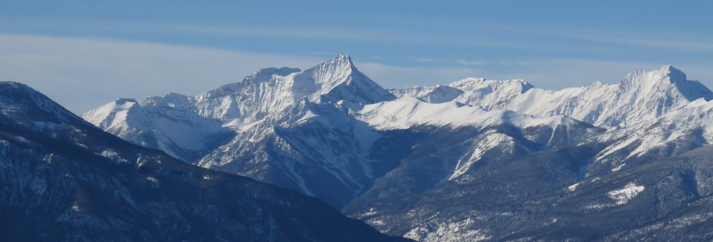
Lead Queen Mountain (Septet Range)
Extensive development work gave the Lead Queen a reputation for being, “unquestionably one of the best developed properties in the Division.”17
An Early Starter
The Lead Queen mineral claim, located up Frances Creek, was first staked in July 1900 by Samuel Derr and Henry Schweisguth.1 Long time valley prospector Tom Brown was also an owner of the claim, although it’s not clear if he was one of the original stakers or if he became an owner only after the discovery.2 The claim was for a silver lead, also known as galena, ore.
The remote location of the Lead Queen group proved to be a problem. High up at the head of the then remote No 3 Creek (now Frances Creek), early access was via a rough trail from Firlands Ranch via John Hurst’s ranch (later Hidden Valley).3 This rough trail meant that it could take a couple of days to get from Wilmer up to the claim, and it made transporting ore out impossible, particularly with very low ore prices.
The claim owners did not let these impediments dull their commitment to developing the Lead Queen group. In fact, it seems their inability to actually ship ore out encouraged them to focus on developing the mine and proving it to be a worthwhile investment.
The property consisted of five claims running up the mountain with the First Effort at the bottom of the gulch followed by the Lucky Strike, Big Chief, Columbia (this one seems to have been renamed numerous times), and the Lead Queen.4
Development Work
Early development work included one cabin was built down in the creek valley, and another further up the hill to be used on the upper workings. Between the two was a well graded, carefully constructed trail complete with two well constructed bridges.5 This is the basis for the later hiking trail up to Lead Queen.
The owners made various cuts and tunnels to gain access to the vein of ore. These included, in the first winter, a 165 foot (50 metre) tunnel on one of the upper claims,6 later extended to at least 240 feet (73 metres), in an attempt to get under the ore. The ground was firm, so little timbering was necessary.7
Another, shorter tunnel as also put in near the bottom of the gulch on the First Effort claim,8 running in at least 300 feet (91 metres).9 The tunnel was an attempt to crosscut the vein in the upper tunnel, but nothing was found.
This lower tunnel is notable as later geologists reporting on the site were unable to locate it and, as far as I can tell, its exact location remains lost.10 In 1903 an observer recorded getting to it by taking “a trail to the west” that started “about a half mile from the lower cabin” coming down the hill.11 It is described elsewhere as being located at an altitude of 6,800 feet (2071 metres) about 400 feet (122 metres) below the upper tunnel and other workings.12
There were additional tunnels and cuts made in subsequent years, including another tunnel not far below the upper tunnel. For a better description of exact developments, the best resource is an 1965 report written for Silverton Explorations Ltd.13
Development work continued nearly non stop from 1900 through 1906, even though the low price of ore and high transportation cost prevented any ore from actually being shipped and therefore any profits from being made.14 Hundreds of tons of ore were made ready to ship, and an estimated $12,000 worth of work was done on the property.15 This included an ambitious new 18-20 mile (29-30 km) trail from the Columbia River at Bott’s Landing (near Brisco) up Templeton River (then Salmon River).16 Together this development work gave the Lead Queen a reputation for being, “unquestionably one of the best developed properties in the Division.”17

The Lead Queen Mine. Annual Report to the Minister of Mines for the Year Ending 31st December 1909, p K 102.
Activity Resumes
Activity on the Lead Queen resumed again in 1915 following the outbreak of the First World War. An increase in lead ore prices and the opening of the Kootenay Central Railway, on 1 January 1915, made shipping ore from the site suddenly much more profitable.18 In August 1915, a work team began completing a wagon road up to the property with the hope of having it completed by the beginning of December.19 The first shipment of 39 tons from the Lead Queen was sent to the Trail smelter around the turn of the new year.20
| Year | Amount Shipped | Owner |
|---|---|---|
| 1900-1906 | None | Tom Brown, Henry Schweisguth, Sam Derr |
| 1909 | None | Tom Brown, Charles Cartwright et al.21 |
| 1915 | None | Tom Brown (Athalmer) and Charles Cartwright (Vancouver) to J.T. Burgess and Barry (Athalmer) in August.22 |
| 1916 | 137 tons | J.T. Burgess (Athalmer) re-sold to unknown party.23 |
| 1917 | 126 tons | Tom Brown and J McLeod (Wilmer)24 |
| 1918 | None | Tom Brown (Athalmer) and James Lorenzo McKay sold to Paul Denhart.25 |
| 1919 | 80 tons | Paul Denhart, Morris Thompson et al (Seattle Wash) 26 |
| 1920 | None27 | Unclear |
| 1922 | None | Alice Arm Holdings Co (Vancouver)28 |
| 1925 | None | J.L. McKay to W.L. Wemple and New York syndicate29 |
| 1926 | 35 tons | New York interests30 |
| 1927 | 45 tons | New York interests31 |
| 1929 | 14 tons | New York interests/ G.L. Larabee, Brisco32 |
Further Development
As ore shipments on the Lead Queen group continued, so too did other development. The company that operated the mine in 1916 built large log buildings at what they called the “Half-way House” including a large stable, bunk house, cook house, manager’s house, office and blacksmith shop.33 It’s not entirely clear where this halfway house and camp was located: there is a Halfway Lake located just before the Frances Creek road goes into the Frances Creek valley, but this may just be coincidence.
Later, in 1925, there was a camp halfway up from Brisco on 40 acres of property held by the Lead Queen owners.34 As the company owning the mine had changed from the one that built the original Half-way House, it’s unknown if this second camp was in the same location. Two 40 acre lots match this vague description: one at the entrance to the Frances Creek Valley (DL 12859), and the other close to where Westside Road now crosses Frances Creek (DL 10969).
At the mine itself a fatal accident from a snow slide in 1918 caused the death of 29 year old Martin F Powell, bringing home the dangers of working through winter at high elevations underneath steep slopes.35 These frequent snow slides required cabins to be rebuilt, and later prompted the construction of an aerial tramway between the end of the wagon road and the mine in 1926.36 It was hoped that the two bucket, 3,500 foot (1065 metre) tramway would allow work to be carried out through the winter by allowing ore to be transported down the mountain without requiring men to cross slide paths.37 A new cookhouse was also opened in 1926,38 followed by a new blacksmith shop and 12 bed bunkhouse in 1927.39
All of this development ceased rather abruptly after 1929, possibly as a result of the general economic collapse that year. The Lead Queen group was not revisited until 1965 when a representative from Silverton Explorations Ltd made a study of the old mining area and workings to determine if further development would be profitable.40 The description and maps of the Lead Queen Group found in this report are very thorough and are an excellent resource for anyone wanting to get an idea of the historic layout of the area. It’s unclear if further development resulted from this report.
The Steele Claim
The Lead Queen mine is not the only mining operation to be located on what is now Lead Queen Mountain. Adjoining the Lead Queen group claims, on the north side of the peak, was the Steele Group. These claims were staked in the early summer of 1900 by John Williamson, Samuel Cobb, Frank Cottle, and George H Scott.41 This was around the same time that the Lead Queen was staked, and it is unclear which came first.
The Steele group was along the same ore lead as the Lead Queen group,42 but was accessed from a different creek valley. Anyone who has gone up to Tiger Pass and over to Shangri-La has followed the approach up to the Steele group. At least one hiking book has misidentified the mining equipment up this route as belonging to the Lead Queen Mine instead of the Steele.43
Work on the Steele included a tunnel on the northern end of the group,44 put in at least 50 feet (15 metres), and a drift of at least 45 feet (14 metres).45 The owners of the Steele and the Lead Queen had similar difficulties in terms of transporting ore out, and development was delayed because of this.
It wasn’t until 1922 that the Steele was acquired by a larger company, Alice Arms Holdings of Vancouver, which put in a cookhouse and bunkhouse with accommodation for eight. The camp was situated on a bench about 500 feet (150 metres) below the main workings, so a small cabin was built on an excavated space nearer to the tunnel to provide emergency shelter. Alice Arm Holdings also put in a 1,500 foot (460 metres) aerial tram for ore to be brought down from the workings to the bench. From there it was brought via a rawhide trail 2 miles (3 kilometres) down to the road.46
Some 221 tons of ore were shipped from the Steele as a result of these efforts, although by 1923 work had stalled due to lack of capital.47 Attempts seem to have been made to restart work at the site,48 but these were unsuccessful.49
Legacy
The name of the Lead Queen mine has officially survived in the name Lead Queen Mountain, on which the group’s claims were made. As an interesting side-note, a now forgotten name was once attached to the small creek draining out of Lead Queen basin into Frances Creek. In 1903, the creek was given the name “BDS Creek” by E.J. Scovil and newspaper reporter William P Evans, in recognition of the three men – Tom Brown, Sam Derr, and Henry Schweisguth – who had done so much work in the area.50 There are occasional mentions to B.D.S. Creek in subsequent mining reports, but it was eventually forgotten.51 It is noted in at least one other location as Lead Queen Creek.52
Footnotes
