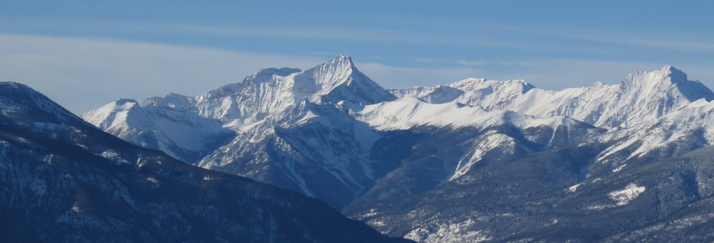
Windermere Townsite, Windermere District, Windermere Lake
“Windermere [was] a magnet for land speculation by government officials.”
The first post on this blog two years ago addressed the origins of the name “Windermere”, and I’ve wanted to revisit the subject for awhile now. Long time readers will notice that the structure of this blog has changed – I’ve gone from careful overviews of topics to shameless deep dives, so that first Windermere post was pretty cursory. Now that I’ve done further research, it’s time for another go. So here it is: complete with plenty of still unanswered questions and quite a lot to think about.
This is the first of two posts, with this one taking a close look at how the name “Windermere” came about, and the suspicious sequence of events that brought about the Windermere townsite.
A Re-Naming
The name “Windermere” originates as a reference to the lake rather than the townsite. The name was reportedly given on 4 September 1883 by Gilbert Malcolm Sproat due to a fancied resemblance of what was then officially known as “Lower Columbia Lake” to England’s Windermere Lake.1

England’s Windermere Lake, From Top of Loughrigg. Postcard (undated)
The Akisqnuk band of the Ktunaxa Nation has its own name for the lake, “?akisqnuk”, and the present-day community of Windermere is known as either “Kananuk”,2 and/or “yaqunaki”.3 A later settler source also suggests that the local Kenpesq’t band of the Secwepemc (Shuswap) Nation also have their own name for the lake, translating to “Salmon Lake”4 (I’ve tried and failed to find further information/confirmation about this).
This latter name makes an appearance in English sources as well, with maps issued in both 1859,5 and 1872,6 labelling the lake as “Salmon Lake.” The designation references its importance as an annual spawning ground for salmon from the Pacific Ocean.

Salmon Lake, more often labelled as Lower Columbia Lake, 1872. Note that Columbia Lake on this maps is labelled “Otter Lake”. J Bartholomew, F.R.G.S. (Drawn and Engraved). British North America. Sheet III. Pacific Coast: British Columbia and Vancouver Island. (A Fullerton & Co: Edinburgh, London and Dublin, 1872).
Salmon Lake
The name “Salmon Lake” was appropriate, as the salmon run defined the ecosystem of the valley. Every year thousands of fish, each weighing between twenty and fifty pounds,7 arrived over the course of months to spawn in the Upper Columbia River catchment. In September 1845, Catholic missionary Father DeSmet describes the lakes as being,
Not only did the adult fish provide a massive amount of food for people, bears, and birds, but the small fry of the next generation provided an equally welcome meal to smaller critters. Then there’s DeSmet’s latter observation, that the corpses of the fish “infect the whole surrounding atmosphere.” It sounds unpleasant, and indeed the smell would have been, but the impact of all of those dead fish was immeasurable. Whether lining the shorelines or sinking into the depths, dead fish makes for a very good fertilizer. Nutrients, accumulating in the shallows and the wetlands, would have supported plant growth and the life cycles of birds, insects, and mammals.
An Official Government Visit
But it was the name “Windermere” that stuck, possibly as it was given during an official government expedition through the region. In July 1883 Gilbert Malcolm Sproat, along with his friend and surveyor, Arthur Stanhope Farwell, had been ordered by the Provincial Government to travel through the Kootenay area to provide a report. The government wanted information about “the value of the country for farming, grazing, mining, and other economic purposes,” as well as a general description of the area, its potential for settlement,9 and a report about the First Nations people living there.10
Sproat and Farwell passed through the Upper Columbia Valley in late summer 1883, by which time settlers had already arrived. The first semi-permanent settler had been Francois Morigeau, back in 1819, who had settled on a property alongside what is now Windermere Creek. He later married Isabella (or Elizabeth) Taylor, the daughter of an Scotsman and an Indigenous woman, and together had eleven children.11
This was long before British Columbia was a colony, let alone a province, and so the first outsider to officially file a land claim in the area with the Province was Edmund Thomas Johnston, who arrived in October 1882, staked land, and officially filed a claim for that land on 9 April 1883.12
Johnston’s lot was followed in subsequent months by three others, all staked by individuals who had been working with the C.P.R. survey in 1882 and wintered up near present-day Golden, venturing south during their stay. These lots included 320 acres along the Columbia River by Frederick Whitworth Aylmer filed on 2 June 1883, another 320 acres on Columbia Lake by Francis Patrick Armstrong on 9 July 1883, and 80 acres by David Bellhouse, also on 9 July 1883.13
These land claims were not viewed favourably by the local Akisqnuk band of the Ktunaxa nation. In a report about the “Kootenay Indians”, written by Farwell following his and Sproat’s 1883 expedition, Farwell notes that these land acquisitions were looked at with “disfavour… [as] these Indians have been anxiously awaiting, year after year, the arrival of the “Commissioner”, and are particularly angry and disappointed at no action having been taken during the past season towards defining their reserves.”14
Claiming the Windermere Townsite
It is uncomfortable, then, that, having noted the “disfavour” with which such pre-emptions were viewed by the locals, Farwell promptly staked out just over 600 acres of land along Lower Columbia Lake (Lake Windermere). This property became “Lot 8”, and it is this lot that encompasses the current townsite of Windermere. Farwell filed an application to purchase the lot on 8 October 1883 on behalf of a former acquaintance of his, John Jane.15

The Windermere townsite lot, Lot 8, first surveyed in August 1885. The “Morigeau Creek” labelled here is now Windermere Creek. The tiny writing just north of the point reads “Boat Landing”, and that’s a “Trail” marked coming in from the north. Crown Grant no 317 (Edmund Parker, 12 Jan 1885), British Columbia Crown Land Grants, Vol 24 (no 0262/0024-0344/0024) year 1884-1885. FamilySearch database img 250 of 385. [cropped]
To understand exactly what is going on with this land purchase we need to take a slight step back and take a closer look at the parties involved. Starting with John Jane.
John Jane
John Jane had come to British North America back in 1857 or 1858 with the North American Boundary Commission (surveying the border with the United States) and, when fieldwork with the commission ceased in 1862, he transferred to the Department of Lands and Works under Colonel Moody with the Royal Engineers.16 Jane went on to work in public service with the Colonial Government as an accountant, a general clerk, a constable, and an unpaid postmaster, until 1868.17 In 1870 Jane was taken on as part of a survey in the interior, at which time he was working alongside A.S. Farwell.18
In 1875 Jane begins to be regularly noted as a surveyor and civil engineer with the Province,19 and he continues to do regular government work until spring 1881, when he set himself up as a merchant at Savona’s Ferry (located between Kamloops and Cache Creek).20 This was where Jane was living in autumn 1883 when his former colleague, A.S. Farwell, filed an application under his name to purchase land alongside Lower Columbia Lake.21 I could find no evidence that John Jane ever visited the Windermere Valley.
Arthur S Farwell
Arthur S Farwell, meanwhile, was a well established surveyor who had been made surveyor general of the newly formed province of British Columbia in 1871. He served in that capacity for the first two governments (until 1878) before going on to work for the Dominion government and the C.P.R. in the early 1880s.22
The Windermere claim was not the only time that Farwell took part in some land speculation during the course of his professional duties. On 20 October 1883, less than two weeks after the Windermere claim was filed, Farwell applied to purchase over 100,000 acres extending twenty-four miles along the Columbia River,23 in the vicinity of present day Revelstoke.24
This was a strategic application for land. The exact route of the transcontinental railway (the C.P.R.) was then still not widely known, but the plausibility of a route through the Selkirk Mountains had just been confirmed by Sir Sandford Fleming,25
W Kaye Lamb, History of the Canadian Pacific Railway (Toronto: Collier Macmillan Canada, 1977), p 117. https://archive.org/embed/historyofcanadia0000unse_r9v4
and the broad boundaries on Farwell’s application were sure to intersect with wherever the line emerged from the Selkirk Mountains to cross the Columbia River.
As the route of the railway became clearer, however, suddenly only a fraction of this original claim was of interest and, just over a year later, on 13 January 1885, Farwell applied for and received a Crown grant from the Province for 1,175 acres on the eastern bank of the Columbia River.26 The C.P.R. line had been surveyed to descend from Rogers Pass along the Illecillewaet River, emerging from the mountains to cross the Columbia River. Farwell’s land purchase encompassed a large portion of the very limited flat land on the east bank of the Columbia River at this junction.27 This is also where he established the Farwell townsite, located where the railway bridge (and the Trans Canada Highway) now cross the Columbia River at Revelstoke.

Original survey for Farwell’s 1,175 acre Lot 6 at present-day Revelstoke. British Columbia. Crown Land Registry and the Office of the Surveyor General. Crown Grant No 319 (Arthur Stanhope Farwell, 13 January 1885), British Columbia Crown Land Grants, Vol 24 (no 0262/0024-0344/0024), 1884-1885. FamilySearch Database, img 263 of 385.

For context: the borders of Lot 6 overlaid with a more recent satellite shot of Revelstoke. (Satellite Image from GoogleMaps) Farwell’s townsite (the “Lower Town”) was on the north side of the lot, where the bridge crosses the Columbia. The C.P.R. constructed its own townsite (the “Upper Town”) alongside its station, which itself was initially located just outside the borders of Farwell’s granted lot (the brown-ish triangle located alongside “Townley St” halfway down on the west side of the lot boundary is the C.P.R. grounds, where the station was located).
Neither the Dominion government or the C.P.R. was particularly happy with Farwell having purchased this land. When British Columbia joined Confederation in 1871, part of the Terms of Union with the Government of Canada were that British Columbia had to surrender twenty miles of land on either side of the transcontinental railway line to the Government of Canada. The Dominion government could then grant land to the railway for stations, townsites, etc. The railway wanted the land that Farwell now claimed, and the Dominion Government went to court with the argument that it wasn’t the Province’s land to grant in the first place.
It took years for the ensuing legal conflict to be sorted out. Farwell had papers from the Province giving him title, allowing him to sell or dispose of the land as he saw fit, and when the Dominion Government issued their own grants for land within the lot, the Provincial Government refused to register them because, according to their records, the land belonged to Farwell.28 The confusion created notoriety, and if you’re at all familiar with Revelstoke history, you will know the name Farwell.
But although Revelstoke is one of the more famous cases of land speculation in the Province, it seems it wasn’t the only one. Farwell was very familiar with how to make the most of British Columbia’s land policies, and he clearly didn’t shy away from working the system. His dealings across the mountains paints his acquisition of the Windermere townsite in a slightly different light: this, too, was very likely meant as a strategic land acquisition, only this time it was made on behalf of a colleague.
The Commissioner Arrives
Back in the Windermere Valley, by the time the long called for “Indian Commissioner”, Peter O’Reilly, finally arrived in August 1884, Windermere’s Lot 8 was already noted in Provincial records as having been “taken”.
This is important as O’Reilly’s visit was not a treaty negotiation. He was there to determine what land should be reserved for exclusive use by Indigenous people living in the Valley, and that decision was remarkably one sided. Certain tracts of land were considered to be off limits.
One of O’Reilly’s goals was that the reserve would not, “materially interfere with white settlement.”29 Land already claimed by settlers, unless that land had already been abandoned, were off the table (there were two abandoned pre-emption claims included in the Akisqnuk Reserve, as well as one claim previously sold to the Band).30
With these limitations in mind, had the Akisqnuk Reserve been laid out even two years previously, its borders likely would have differed, and may even have included land bordering Windermere Creek. As is, the jagged northern border of the Reserve follows the border of Lot 8 as well as the adjacent Lot 108, two properties previously claimed by settlers in October 1883 and one (Lot 8) with an “owner” who likely never set foot on the land.

Lots claimed near Windermere by settlers before the Akisqnuk First Nation boundaries were laid out in August 1884.
Lot 8 is Sold
John Jane did not remain the owner of Lot 8 for long. On 23 October 1884, a year after the announcement of his intention to purchase the land, Jane signed an affidavit in Savona giving Gilbert Malcolm Sproat (the guy who decided on the name “Windermere”) the Power of Attorney to apply for a Crown grant for the property, and to subsequently put the property up for sale.31
It is very likely that a deal for the land had already been arranged, as this sale did not take long. On 17 November 1884 Sproat signed papers on behalf of Jane to confirm the receipt of $50 for the sale of the lot to one Edmund Parker “of Kootenay District.”32 A former army officer, Parker had served for twelve years out of India and England, reaching the rank of Captain before retiring his commission and settling in British Columbia as a farmer.33
The same day that money was received from Parker, a receipt was issued to him by the Province confirming that he had also paid the $5 fee to apply for a Crown Grant.34
At first this entire transaction involving the sale of Lot 8 to Edmund Parker seems straightforward enough, that is until one considers the amount paid. Under the new 1884 Land Act the cheapest land in the province, what were described as “mountainous tracts of land unfit for cultivation”, could be purchased from the Province for $1 per acre.35 Lot 8 was surveyed to contain 613 acres, so the minimum purchase price from the Government was $613. Why would Jane and his agent accept an offer for purchase of just $50?
The answer remains somewhat ambiguous, simply because I haven’t found overt documentation, but there is enough circumstantial evidence to draw some tentative conclusions. On 1 November 1884 there is a receipt indicating that $613 had indeed been “received from” Kootenay government agent Arthur W Vowell “for John Jane.”36 A Certificate of Purchase for Lot 8 was also issued on November 1st to Edmund Parker, on which Vowell recorded having received the full $613 for the purchase of the lot.37

Receipt, dated 1 November 1884, for the purchase of Lot 8, with money “Received From” A.W.V. for John Jane. Crown Grant no 317 (Edmund Parker, 12 Jan 1885), British Columbia Crown Land Grants, Vol 24 (no 0262/0024-0344/0024) year 1884-1885. FamilySearch database img 254 of 385.
So the full $613 was received by the government for the purchase of the lot, but there is no indication that it was Parker who paid it. Instead, the receipt for the full $613 only contains the names of Vowell and Jane. It doesn’t make sense for Jane to have paid the full $613 fee only to turn around and sell for a mere $50. So if the money didn’t come from the pocket of Parker or Jane, the only name left is Vowell’s.
Indeed, early settler Edmund T. Johnston recalls that Jane sold the lot to Vowell, who then sold an interest to Parker.38 As mentioned, Vowell was then the province’s official agent in the Kootenays: he was the area’s Gold Commissioner and Magistrate, and if one wanted to file a land claim, they would do so at Vowell’s office. In effect, this explanation for the sale of Lot 8 meant that Vowell was privately purchasing land while also serving as the official government authority legalizing that purchase.
This remains the most plausible explanation for the transfer of Lot 8 and, if true, it would make the Windermere lot a magnet for land speculation by government officials. First Farwell, Jane and Sproat, and now Vowell, all without giving the Akisqnuk First Nation the opportunity to reserve the land for their own use to begin with.
The Town of Windermere is Created
Regardless of the possible back-room dealings, it was Parker who was issued a Crown grant for Lot 8 on 12 January 1885,39 and it is at this point that we also first see the name “Windermere” attached to the property in newspaper records.40 An official survey was made later that summer, following which it didn’t take long for the very early beginnings of the Windermere Townsite to form.
In late 1885/early 1886 the B.C. Government purchased just under 10 acres of Lot 8 “from the Parker Company”41 and in January 1886 government buildings began to be constructed on the site.42 It should certainly be noted that, if Vowell did even partially own the lot, than this decision to purchase land on behalf of the government was, shall we say, ethically interesting. As Vowell was the one who would have decided what land the government should purchase, he would have been purchasing the lot from himself. As I said at the outset, there are still questions to be answered.
This initial government building at Windermere would soon (creatively) be named Government House and, in the year following construction, additional work was done on the building, described as “repairs.”43 After two seasons of work, Government House was reported in September 1887 as having four rooms, a cellar, and being “barely furnished, and at present guiltless of chimneys.”44

A sketch of Government House, summer 1887.

The original “Government House,” taken c.1921, incorrectly labelled in BC Archives records as having been built in 1882 (it was 1886-1888). Item B-04353 – “The Windermere government office, built 1882.” BC Archives (Victoria B.C.)
At some time following, Government House was augmented by two additional log buildings,45 which by 1890 comprised of a residence, gaol, and a stable.46 These buildings, such as they were, do not seem to have been used much by the government itself under government ownership. Instead, they and the property they stood on were put up for sale in June 1890, at which time they were purchased by R.L.T. Galbraith (Galbraith outbid F. P. Armstrong by $30).47
The value of the land and buildings had increased somewhat since Parker/Vowell had purchased Lot 8 from the Province: the 8.5 acres were purchased by Galbraith for $1,055 (Galbraith got good deal: the Government had spent $2,281.84 to build/repair Government House). One of these government buildings would later be used, starting July 1892, as headquarters for the first Mining Recorder’s office in the newly formed Windermere Mining Division, then run by George Goldie.48

Survey of the sub-lot containing Government House, c.1890. Crown Grant No 1125/52 (Robert L.T. Galbraith, 14 November 1890, Part of Lot 8), British Columbia Crown Land Grants, Vol 52 (no 1084/0052-1182/0052) year 1890-1891. FamilySearch database, img 307 of 762.
A Hub of Activity
As strange as it is to have a “Government House” only used by the government after it had been privately acquired, back in 1886 the newly constructed Government buildings served to define the area as the commercial centre of the region.
The location of Lot 8 had certain advantages. It encompassed the long-used trail connecting the north and south of the valley; it was beside the lake, which was an increasingly important transportation corridor; and it was in close proximity to much of the population then living in the area: both the Akisqnuk Reserve, and increasing numbers of settler farms on the surrounding benchlands. If there was to be an economic hub in the valley, the area on Lot 8 close to Government House was a better place than many.
And, beginning in 1886, an economic hub was becoming necessary. To put this time period in perspective (there’s a whole lot of links here if you want to follow them), once regular cross-country passenger traffic started along the newly completed C.P.R. in June 1886, the Upper Columbia Valley was suddenly much easier to access. With easy train transport as far as Golden, in late spring 1886 the first steamboat on the river, the Duchess, was launched. This was shortly after her financial backer, Thomas B Cochrane, had (with James Brady) gained a concession from the BC Legislature for land and privileges to develop their Findlay Creek Hydraulic Mining Company.
Permission was also granted in 1886 for plans promoted by William Baillie-Grohman to construct a canal connecting Kootenay and Columbia Rivers. Actual construction on the feature that gave Canal Flats its name began after final plans were handed down in the summer of 1887.49
Meanwhile, at the beginning of 1887, tensions had heightened to the south between certain settlers and members of the Ktunaxa Nation, spurred on by a series of events that are the focus of a post of its own (see Body Creek). A contingent of North West Mounted Police (NWMP) officers was sent into the Kootenays in July 1887, with the main force promptly constructing Fort Steele to spend the winter.
A secondary police force also stayed up along Lower Columbia Lake somewhere on the Akisqnuk Reserve, where they may or may not have stayed through the winter. There is a newspaper note at the very end of 1887 suggesting that this sub-force would take over Government House in Windermere for the winter,50 but I haven’t seen any primary source record confirming that this move was made – the last steamboat of the season into Windermere Lake delivered provisions to the contingent at their location further south.51

North West Mounted Police expeditionary force encampment at Lake Windermere, 1887. An account from late August 1887 reads: “Our present errand was to deposit stores for the police contingent at this little log hut, where three of them were quartered. That finished, we steamed back a few miles to Windermere.” [emphasis added] (Lees and Clutterbuck, B.C. 1887, p 105). Image: Item A-04102, BC Archives.
I’ve stared at this photo more times than can be counted trying to decide exactly where on the lake this camp was located. Ideas?
Conclusions
To summarize, then, in just a few short years the shores of ?akisqnuk/Salmon Lake had gone from an area largely undisturbed by settlers to one very much controlled by them. Newcomers had staked land before the people living there were even permitted to officially claim it, and the Windermere townsite lot was subject to repeated land speculation by government employees. Government buildings were erected on the lot only to be sold after just a few years.
It was a promising beginning.
But starting in 1886, picking up in 1887, and continuing into 1888 there was also a massive amount of traffic passing through the Windermere Valley. Equipment was being sent south from the CPR line for the Findlay Creek Hydraulic project and the Canal Flat scheme, as well as to provision the contingent of the NWMP. This, in addition to a general increase in traffic thanks to easier access via train and steamboat, meant that Government House was soon joined by some other buildings.
Which we’ll get into in more detail, and more, in part 2.
See Also
Windermere (Kananuk) (Original Post)
Edmund T Johnston
Frederick Whitworth Aylmer
Athalmer
Francis Patrick Armstrong
Arthur Wellesley Vowell
George Goldie
The Duchess
James Brady
William Baillie-Grohman
Canal Flats
Body Creek
Footnotes
https://dx.doi.org/10.14288/1.0106901
https://dx.doi.org/10.14288/1.0311695

Another fascinating post. Thanks for doing the research and writing.
LikeLike